
Bering Sea Research Cruise
USCGC Healy, July 3 - 31, 2008
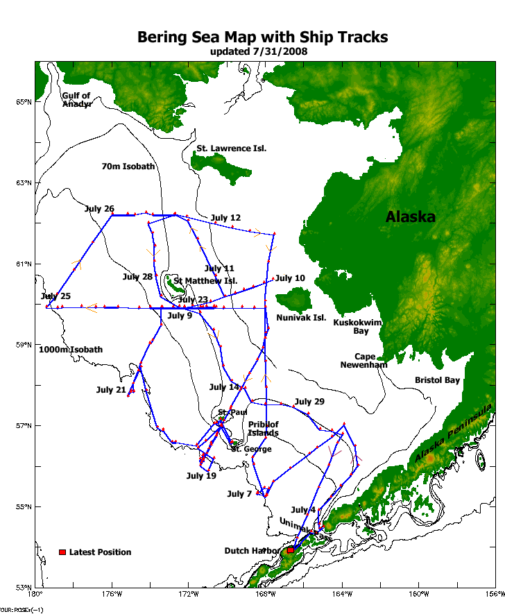
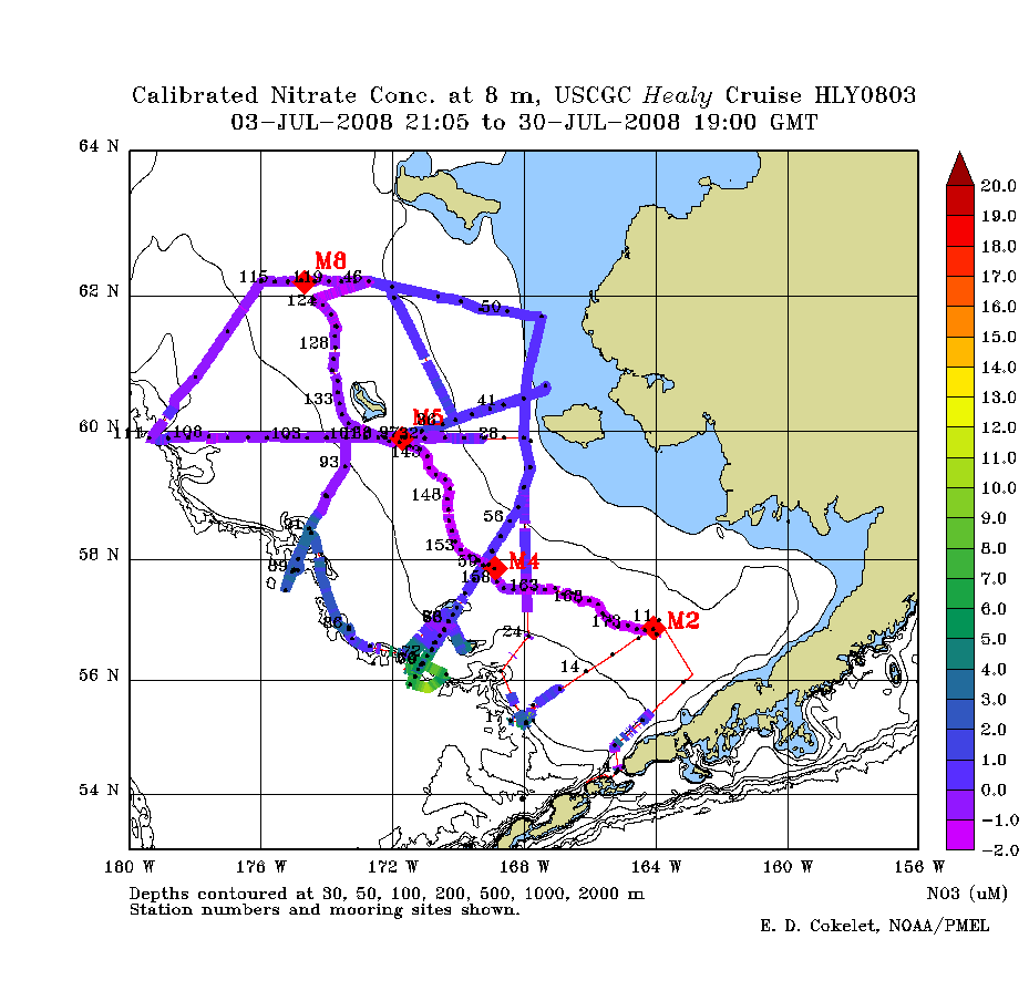
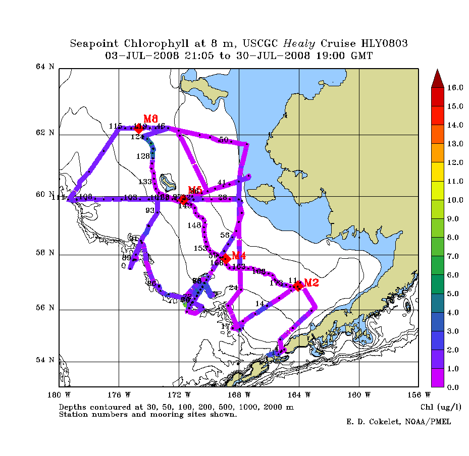
| View resources from our July, 2008 EcoFOCI Bering Sea research cruise. This page contains a cruise-track map, preliminary data plots (line and contour plots), and related cruise items. Additional coverage for this cruise (hl0803) can be seen at the BEST-BSIERP site (plots, event logs ). Also, view the previous USCGC Healy Ice Expedition Cruise, Spring 2008. | 
Quicktime Movies 10.5 MB * 43.5 MB |
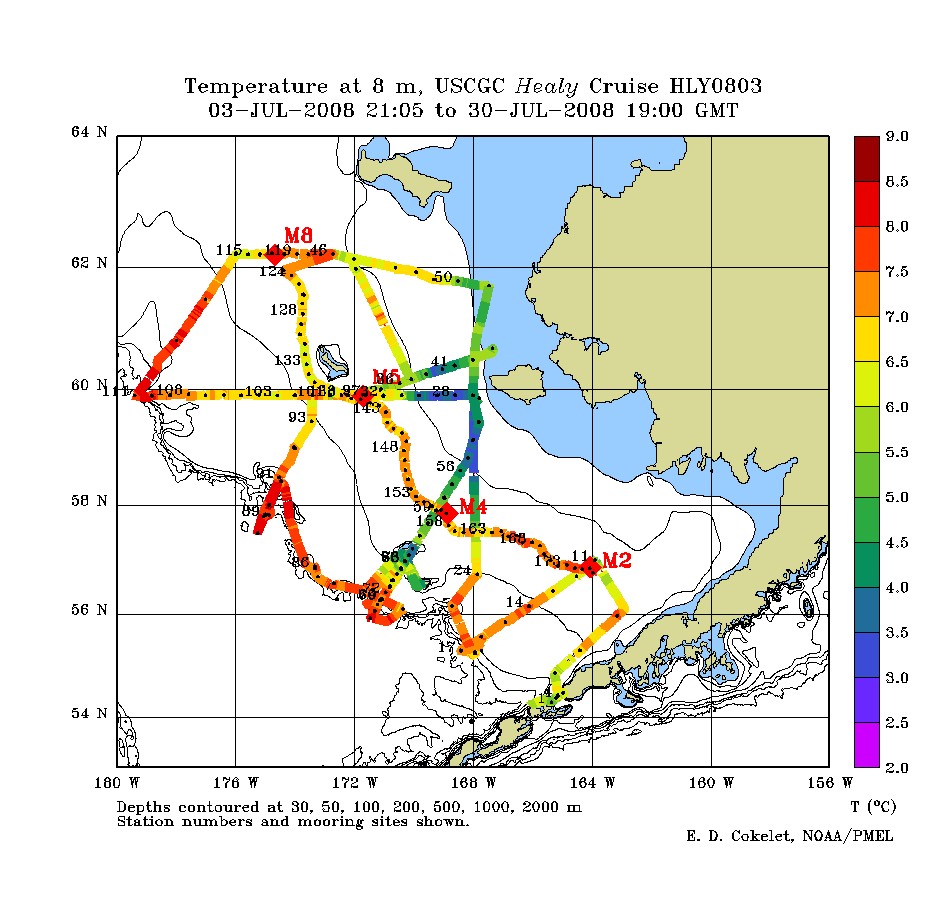
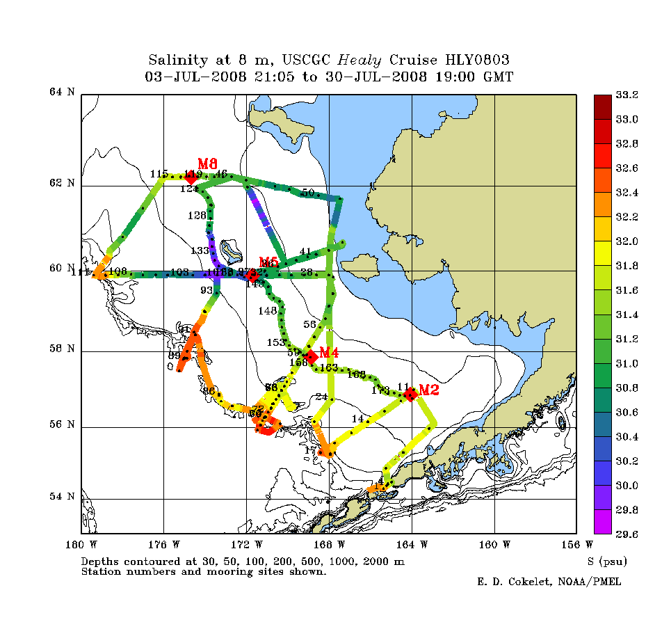
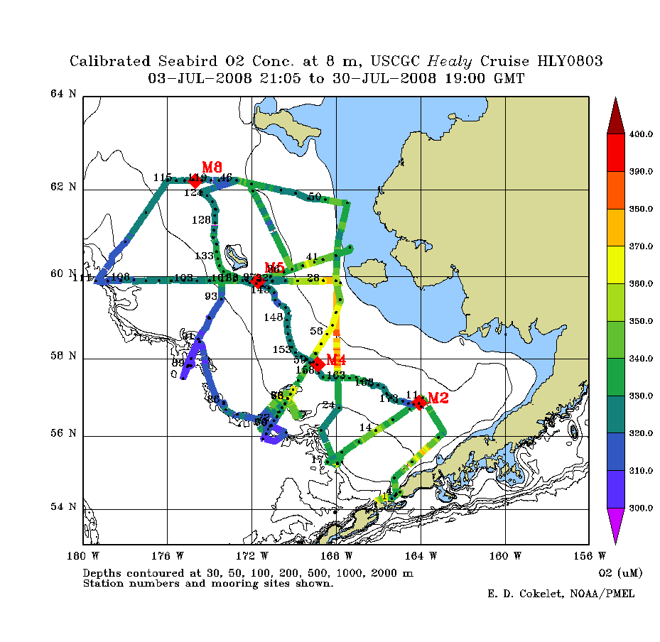
Preliminary, un-calibrated CTD Data
|
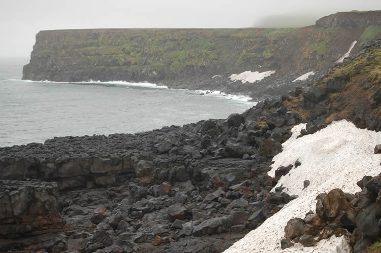
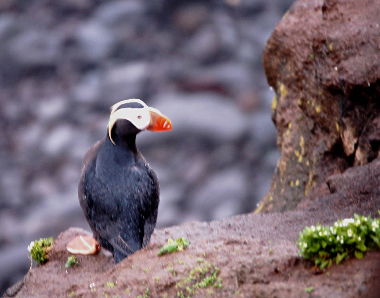
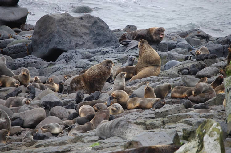
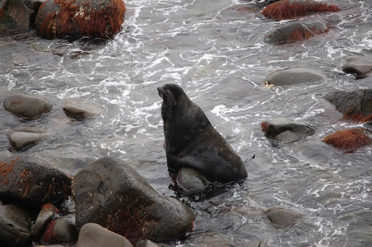
| Photos at St. Paul Island, Pribilof Islands. | |||
|---|---|---|---|
 |
 |
 |
 |
|
|
 |
| EcoFOCI Project Office, NOAA/PMEL and NOAA/AFSC | |
| 7600 Sand Point Way NE Seattle, Washington 98115 Comments and information |
|