
Bering Sea Ice Research Cruise 2009
USCGC Healy, April 4 - May 12, 2009
| Page Updated: 5/15/09 |
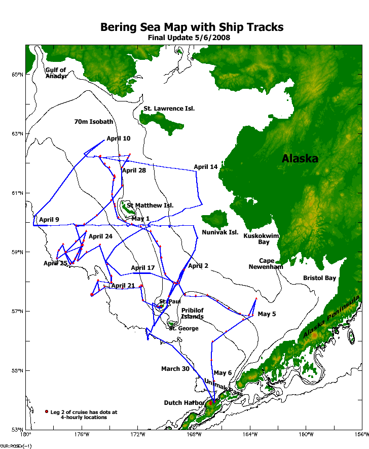
Our Spring, 2009 Bering Sea research cruise aboard US Coast Guard Cutter Healy has finished. We left Dutch Harbor, Alaska on April 4 and returned there late on May 11, 2009. Our research, a part of the NSF-BEST and NPRB-BSIERP programs in conjunction with NOAA's NPCREP, examined the transition from winter conditions, with well-mixed water column and annual ice, to spring, the bloom, the thermocline and productivity that jump starts the seasonal food web and ecosystem in the Bering Sea. Our research cruise travelled through ice and open waters of the eastern Bering Sea shelf mostly north of the Pribilof Islands. We have been as far west as the International Date Line and shelf slope, north of 62°N, and east almost to Nunivak Island. Links below will show you where we have been, stories about our work, and some data that were sent from the ship. |
Quicktime Movies 0.2MB * 8MB |
|
View: PolarDiscovery GoogleMap with Images Coverage at other Sites: BEST-BSIERP - PolarTrec Teacher-at-Sea - Washington Post Article |
|
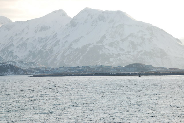
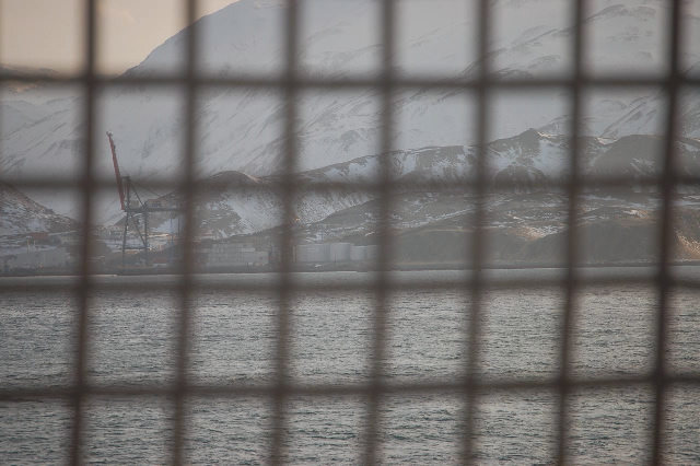
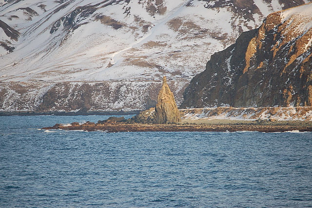
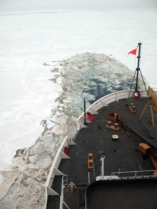
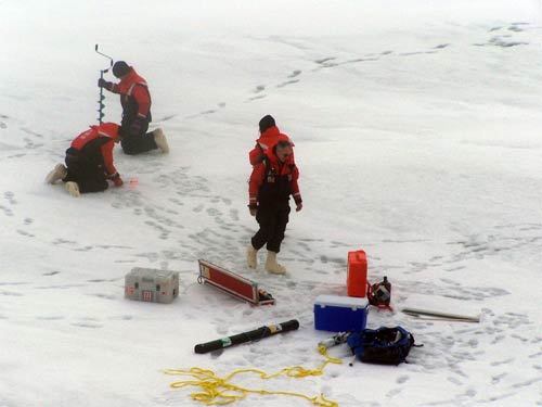
| Departing Dutch Harbor, Alaska | Walrus on Ice | PMEL on Ice | ||
|---|---|---|---|---|
 |
 |
 |
 |
 |
| Dutch Harbor receding from view. photo E.Cokelet | From the confines of USCGC Healy. photo E.Cokelet | A view of Priest Rock as we leave Dutch Harbor. photo E.Cokelet |
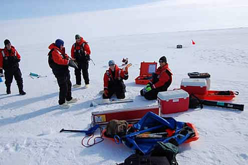
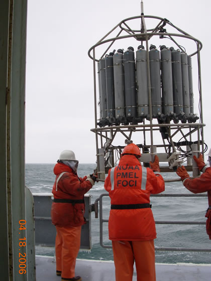
Walrus on ice, SE Bering Sea shelf in early April. photo E.Cokelet | EcoFOCI scientists sampling at an ice station in the Bering Sea, April 7. photo N.Kachel |
|
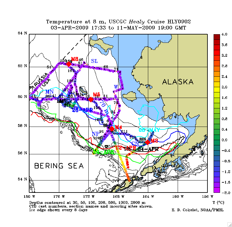
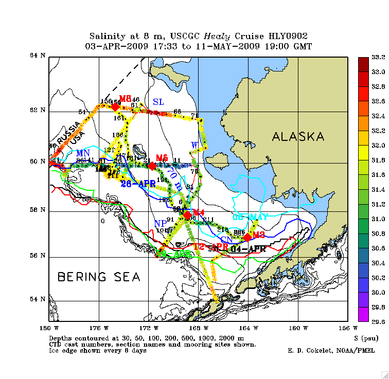
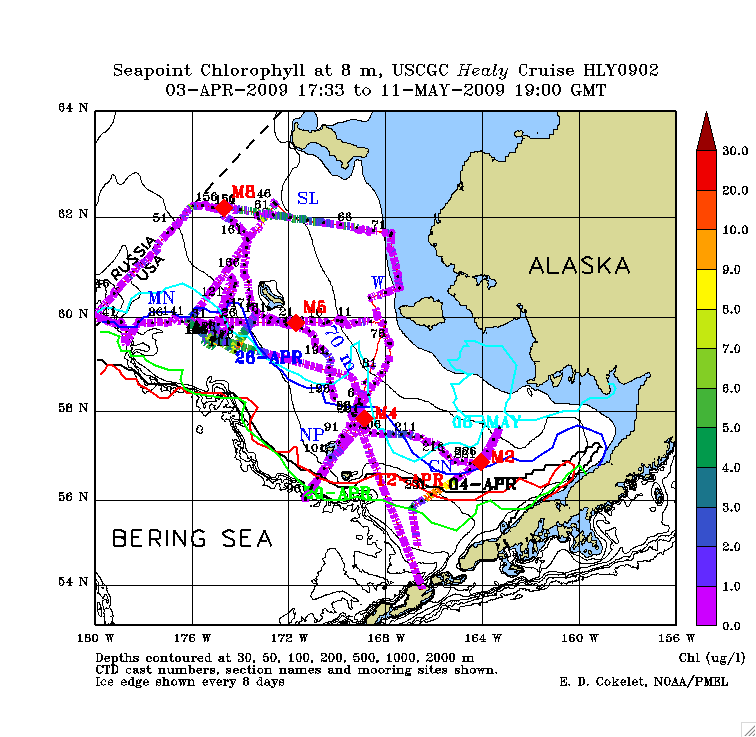
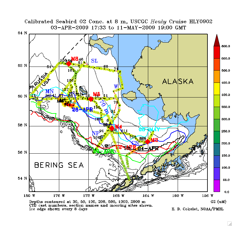
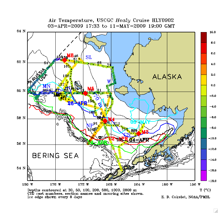
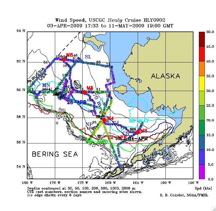
Water samples from the underway seawater sampling system were analyzed to obtain these along-track data, with plots shown below: temperature, conductivity (for salinity calculation), chlorophyll concentration, nitrate concentration and dissolved oxygen values. Additional plots: air temperature and wind speed. [click for full size] |
       |
| Previous Spring Ice Expeditions: 2006 - 2007 - 2008 |
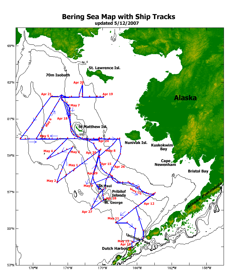
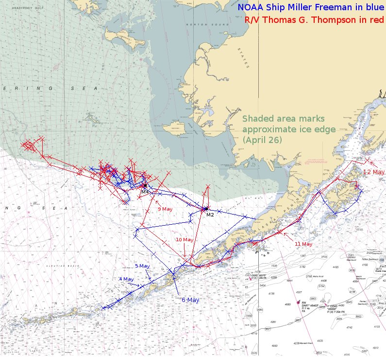
| Cruise tracks from previous Expeditions |
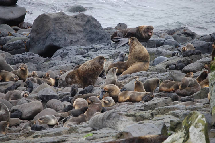
| Photos from previous expeditions | |||
|---|---|---|---|
 |
 |
 |
 |
| Deployment of CTD. photo P.Sullivan | Healy in ice, algae colors.photo D.Hyrenbach | Steller Sea Lions on St. Paul Island photo E.Cokelet |
Ice-coring team in 2007 photo C.Ladd |
| EcoFOCI Project Office, NOAA/PMEL and NOAA/AFSC | |
| 7600 Sand Point Way NE Seattle, Washington 98115 Comments and information |
|