|
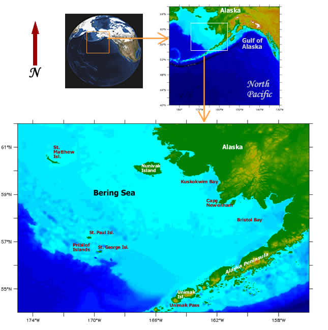
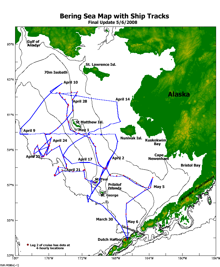
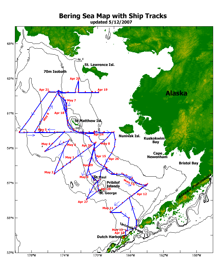
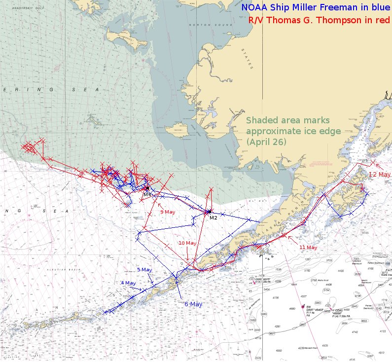
Maps and nautical charts, are an important part of ocean
navigation and exploration. These show our location, and our tracks during the ice expedition. Maps can be used to show changes in water parameters (for instance, temperature and salinity) along the track of the ship, and we will include those maps as they are created during the cruise.
- Final ship tracks map for this Expedition
- Ship tracks for the Ice Expedition in 2007 and 2006
- See the recent location of USCGC Healy on sailwx site
- Ice Maps of the Bering Sea (April for 16 years (1990 to 2005)) See how ice characteristics change from year to year by comparing data from the same month.
|

